Showing posts with label cultural mapping. Show all posts

Sunday, 2 August 2009

Cultural Exploration & Digital Storytelling

Lancashire County Council and Preston City Council are working in collaboration with the Sandbox in using new cultural mapping strategies to explore cultural and social relationships in communities and for business alike.

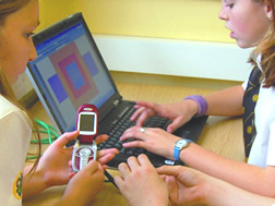
The sandbox uses mobile phones and GPS technology to allow participation to document, record and write experiences in real-time and upload those files via video, SMS, sound and image directly from the mobile phone to a website to be shared with the all participants. Web-based projects provide a space for communities to utilised new social media tools to connect to others and be active author in promoting their values and local needs.
Sandbox facilitators employ new creative media tools, designed specifically to enable participants to gather and store relevant information, to bring people, their stories and digital technologies together in a creative and user-friendly way.

Monday, 27 July 2009

New Cultural Journeys

Imagine!!! Capturing the rain or changes in the weather and turning this into a sound space of information, a local narrative or participatory game space! The idea would be to use transmitters to network the public into a common art experience along the coast of Lancashire.


Hertzian Rain by Mark Shepard - is a live sound project which filters multiple sound and is streamed from a set of wireless transmitters placed in an urban space. The transmitters broadcast the live audio stream locally on the same radio frequency to participants who are wearing wireless headphones tuned to this frequency.

This event is designed to raise awareness of issues surrounding the wireless topography of urban environments through audio experiences based on sound and movement.

Participants carry umbrellas made of electromagnetic field (EMF) shielding fabric that enable them to actively shape the surrounding environment of radio waves. By orienting the umbrella in different ways, one is able to filter the interfering radio signals and select a single audio stream to listen to. The movements of the crowd are sensed by accelerometers attached to the umbrellas and this data is broadcast locally to the sound makers via an ad-hoc wireless network, who in turn use these data streams to modify the sound streams.

Sound sources might include real-time ambient sounds produced by a sound artist, a spoken word performance or live music from a local or remote location mixed in real-time by mobile DJ, for example.

This is one of many exciting projects by Mark Shepard.

Sound Garden + Networked Public Spaces

The Tactical Sound Garden [TSG] toolkit is an open source software platform for cultivating public "sound gardens" in the city. It can be used to create social public spaces for people to participate in an digital environment to build a technologically mediated garden.

Working with mobile audio devices like the iPod, the toolkit enables anyone with access to wireless (WiFi) "hot zones" to install a "sound garden" for public use. Using a WiFi enabled mobile device (PDA, laptop, mobile phone), participants "plant" sounds within a positional audio environment.

These plantings are mapped onto the coordinates of a physical location by a 3D audio engine common to gaming environments - overlaying a publicly created soundscape onto a specific urban space. Wearing headphones connected to a WiFi enabled device, participants drift though virtual sound gardens as they move throughout the city.

Invader :: Street art play & cultural mapping

Invader is an artist who uses the city as his canvas to place mosaic characters of the computer game SPACE INVADERS throughout the city. This has been done in cities across the world, with maps and images of these mosaics available online. There are many websites where the public have documented these INVADERS themselves and how many times there been seen to build on the artist's map.


Creating a cycling route along the Fylde coast, around Morecambe, throughout the city of Lancaster and Preston; new street art, sound scapes or outdoors games could become part of a cultural mapping environment where people cycle from A-B in search of new art installations.

To see some of the images captured by the public of Invaders in various cities go to:
BIG ART MOB


Research -- Bike Sharing

Research provided by Bike Sharing Solutions

Call a Bike

Call a Bike is a bike hire system run by Deutsche Bahn in several German cities, which uses a system of authentication codes to automatically lock and unlock bikes.


To hire
Customer calls the telephone number given on the bike which includes the bike's ID and gets by voice the 4 digit opening code, which he then types onto the bike's touch screen to unlock it

To return
Lock the bike to a fixed object, and select "return bike" from the bike's touchscreen. A code will be generated which then has to be telephoned to the control centre, as proof that the bike was locked. As well one has to give the exact street names of the cross roads, which has to be within the permitted town area.

The Technology involved
Comprised of an electronic wheel lock and a cable lock, all controlled by embedded microcontroller with touchscreen LCD display. A set lock/unlock codes are unique to each bike and stored in memory.

re:blogged from Wikipedia

MAP - Memories about Preston

MAP, is an online mapping project that offers members of the Preston community the opportunity to share their own opinions, stories and memories of the city centre. This interactive mapping project was developed in association with the Harris Museum & Art Gallery’s Access and Inclusion department.


This project was launched as part of the In Certain Places project: City Conversations: a collection of artworks which explore the city as a site for dialogue and exchange. The core idea was developed to provide alternative ways of communicating and sharing memories, and to encourage conversations about Preston city centre. This project was developed by artist Chris Davis of Alison who also developed The Family project.

Friday, 24 July 2009

SMARTcode, SemaCode and Tagging

Semacode is a type of barcode. Instead of parallel lines, Semacode looks more like a jumbled pattern of black and while squares - like a crossword puzzle. The coded information can connect users to the Internet to get more information including images or directions.

Until now, Semacodes have been used with mobile phones with built-in cameras! The user can capture a semacode while on a journey through the city, access a website with information about where they are and download the info back to their phones.

Data Matrix Symbol

Active Audiences // Engaged Public

Creative potential of mobile devices are a significant emerging media platform that can be used for innovative projects across cultural actives. Tools such as navigational technologies such as GPS, messaging services via SMS and digital image exchange via MMS - provide an interactive network between artists, audiences and the world around them. Mobile and wireless communication devices - in the hand of the public - allow their involvement in the creative process and to actively shape their own art experience.

Mobile communication devices can be used for projects that involve:
- Episodic narratives; text messaging
- Cross-platform production; image, sound and video up-loads
- Digital audio spaces; using GPS or RFID tags
- Mapping virtual and physical spaces; location aware technologies, Smartcodes

Wednesday, 22 July 2009

Mapping Fylde Coast, Morecambe and Lancashire

To help in the design of a new cycling path or public path - one which is interactive and responsive to the way people use and navigate their journey - a new trail would need a form of WAYFINDING nodes to help guide riders along as well as to pin-point where along the journey the path becomes interactive....

New mapping applications (digital) and identification markers (physical) may need to be considered to help people use and navigate the environment with GPS devices such as the mobile phone.

The Mobile City


The Mobile City is about Mobile Media // Urban Culture // Locality
Mobile media has become an interface between virtual spaces and the city! Merging the digital world with the physical world, people can upload and share real world experiences back to the digital world with other people.

The Mobile City project describes the use of location aware technologies and mobile devices to understand how those technologies can transform our experiences of urban culture.
  • working with interfaces referencing space/map/places; for instance Google Earth-mash ups or TomTom devices.

  • creating interactive, responsive geographic places for teh design of maps, to build on local meaning and chart new territories.

  • trace objects and people on the move using locative media and to coordinate realspace social networking.

  • using of locative media as a ‘space making devices’, altering the experience of a certain space through mobile phones SMS for example.

NY Bicycle Film Festival

The New York Bicycle Film Festival took place in June, 2009. Its remit is celebrating the bicycle!! The idea is to engage with the lifestyle of cycling through art, film, music and performance and to advocate the bike as formidable transport device!

The programme is filled with action-based film footage shot by a variety of cycle enthusiast:

1) DRAG RACE NYC
City bike race between cars (caution this is risky business)


2) LONDON CALLING

Mad Skills - London's finest doing the High Tech Weave (HTW) in this high speed alleycat:


Saturday, 11 July 2009

Songbike

"Come out for a ride + make a bicycle soundscape"

Songbike is a sound-based project by artist; Kelly Andres. Installed on a bike, is a mobile sound lab, which records and automatically uploads audio to a website. Songbike connects people with shared interest in community and aurality; allowing them to self author and self-produced content and social interaction.


Friday, 10 July 2009

Walking & Drawing: Mapping your journey

Jeremy Wood is an artist who uses GPS navigational technologies to map out his journeys as a drawing. The line drawings become a personal document of the playful; walks he creates. Part of this physical map making, Jeremy designed the biggest IF and other fun words.
Snapshot of walks created by Jeremy:

Tuesday, 30 June 2009

Mobile exploration of location & place - NW

The artwork of Jen Hamilton, Jen Southern & St Amand investigate social and tactile approaches to technology and work with audiences to explore location and sense of place. Their projects explore how new technologies influence the way we inhabit an environment and collaborate with industry on the development of new tools for creating collaborative maps.

running stitch

Distance Made Good: Flow Lines (2004), Hamilton and Southern worked with local people to make a new map of Lancaster and Morecambe, UK, by using the Landlines system based on the lives of the people living and working there, and of the places.

The walkers (a group of local residence) were invited to make journeys that in some way represent who they are in conjunction with being a landmark for the city they live in (e.g. A participant in Morecambe took us for a walk along the seafront, as for him the seafront represented Morecambe, and it was a route he regularly took when walking his dog).

Thirty four walks were recorded using a GPS device, and were represented together in the gallery on two map like screens folded into the space.

In their project: Running Stitch (2006) the artists gave exhibition visitors a GPS-enabled mobile phone to track their journeys through the city centre. These walks created GPS line drawings of the walker's movements projected live in the gallery to disclose hidden aspects of the city. Each line drawing was sewn in real time into a large 5m x5m hanging fabric to show an evolving tapestry that revealed a sense of place and interconnection between the walkers and the city. (re:blogged from their respective websites)


Mapping & Community Engagement - Liverpool


Liverpool-based artist Alan Dunn worked in collaboration with Re-Dock throughout 2009 to develop a series of creative consultations, inviting communities from North Liverpool to put forward imaginative ideas for the future of Leeds-Liverpool canal.

Cultural mapping projects and working in situ with communities is becoming a strong methodology for creating interactive and participatory projects involving mobile and wireless technologies. Through the use of location aware media mobile technolgies (these include GPS location devices) audiences are given tools to author or input their own information about where they are or what they find important in their surroundings at any given moment.

Mobile technolgies are tools that can inspire >> real world << interventions as well as allow people to network between each other sending and sharing creative content including photos and videos.