The artwork of
Jen Hamilton, Jen Southern & St Amand investigate social and tactile approaches to technology and work with audiences to explore location and sense of place. Their projects explore how new technologies influence
the way we inhabit an environment and collaborate with industry on the development of new tools for creating
collaborative maps.


Distance Made Good: Flow Lines (2004), Hamilton and Southern worked with local people to make a new map of Lancaster and Morecambe, UK, by using the Landlines system based on the lives of the people living and working there, and of the places.
The walkers (a group of local residence) were invited to make journeys that in some way represent who they are in conjunction with being a landmark for the city they live in (e.g. A participant in Morecambe took us for a walk along the seafront, as for him the seafront represented Morecambe, and it was a route he regularly took when walking his dog).
Thirty four walks were recorded using a GPS device, and were represented together in the gallery on two map like screens folded into the space.
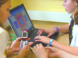
In their project: Running Stitch (2006) the artists gave exhibition visitors a GPS-enabled mobile phone to track their journeys through the city centre. These walks created GPS line drawings of the walker's movements projected live in the gallery to disclose hidden aspects of the city. Each line drawing was sewn in real time into a large 5m x5m hanging fabric to show an evolving tapestry that revealed a sense of place and interconnection between the walkers and the city. (re:blogged from their respective websites)