 >> your journey outlined on google maps <<
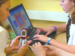
Landlines is a multi-user drawing tool for mobile phone and bluetooth GPS, that allows users to draw by moving in real space. As you walk through the city with Landlines your latitude and longitude is periodically sent via mobile phone to a database. A website then displays your live tracks.


No comments:
Post a Comment